Showing posts with label Lelegian. Show all posts

Sunday, 10 March 2013

Termera - The facts.


I apologise in advance if this is a bit dry,  I've condensed the salient points as much as I can to stop you dropping off. 


As we stalwart walkers made our way up the almost imperceptible  rough path to the ancient walls of Termera,  it was easy to appreciate the strategic importance of this site. Surrounded by fertile arable land and overlooking the present day Greek Islands, Termera was for a time, the richest settlement in the area, paying 2.5 talents to the Delian League in 447BC. Like the other 7 Lelegian towns around ancient Halikarnasus, Termera consists of an inner fort on a defendable peak, surrounded by thick stone walls and naturally treacherous  descents.  Following the line of the walls we came to a stop at a rock tomb fronted by a recent excavation trench.  After 10 years of land surveys, Dr Adnan Diler from Muğla University became concerned at the extent of the illegal treasure hunting in the area and with the support of Turgutreis Town Council and the Archaeology team at Bodrum Castle, he obtained permission to start digging to preserve what remains of this settlement.  His first season in 2012 has already produced evidence of occupation from 7th Century BC.  Historical sources tell us that Termera was ruled by  Tymnes, his son Histiaios and grandson Tymnes in the 6th and 5th centuries BC  and we have physical evidence that this dynasty produced coinage in the shape of a silver coin with a kneeling figure of Herakles and the word TYMNO on one side and a lion's head and TEPMEPIKON on the other.  Charles Thomas Newton relates in his diaries how he bought the coin from a merchant in Kos in the 1850s.  It is now in the British Museum. In the report of his discoveries in Halikarnasus, Newton mistakes Aspat Hill on the coast as the site of Termera.  Later excavations identify the present site on Asarlık Hill.


While researching the site, one phrase turns up again and again; "Termeran Evil" or "Termeran Mischief". A term I hadn't come across before but refers to an action where an evil doer is given a taste of their own medicine.  The myth being that Termenos, (who could be Tymnes 1st )  the founder of Termera,  a "Lelegian of beastly nature" and a notorious pirate was fond of getting rid of his enemies by cracking their skulls with a lethal head-butt.  Herakles killed Termenos by first drugging him and then crushing his skull.  George Bean puts forward the theory that the phrase reflects the suffering of the people of Termera when Mausolos forced the population to leave their homes and move to his new capital Halikarnasus.  A return being permanently blocked when he turned their city into a prison.  Evidence from past excavations seems to prove that the city population was much reduced in the 4th century BC. 


As usual I read up on the site after I visited so a second trip will have to be made as there is a 9 metre long, double vaulted cistern and several tombs which we didn't get to see.  This time I will drive to the village of Mandira and try the shorter, less precipitous route to the top.


Tuesday, 5 March 2013

Walking with friends.


I don't usually do group walks as I prefer to wander around at  my own pace, but when H3A announced that they were walking to the ancient Lelegian town of Termera, accompanied by two archaeologists who had been involved in a recent rescue excavation on the site, I was keen to join in.  It's always a joy to visit a site with an up-to-date source of information, rather than second-hand knowledge trawled from the internet. It would also be a novelty to walk cross-country to a Lelegian or Carian site without getting lost en-route. 
The walk, initially planned for the end of January, was postponed twice because of heavy rain so it was the end of February by the time we all convened in the village of Akçaalan above Turgutreis to start  the ascent.  The head count was an impressive 50, which is an amazing number for a Sunday in February, unfortunately this figure did not include the two archaeologists, who couldn't attend so we were without our experts. 


After a brief pep-talk by team leader Ali Bey, with a reminder to not disturb any relics, we were off at a brisk pace.  I'd arrived with a friend I've known for 30 plus years, and we happily strode forth, chatting all the way. With several other old friends and a sprinkling of new ones in the group, I realised that walking en masse is actually a very enjoyable activity. Especially in beautiful spring sunshine, surrounded by blossom and wild flowers. I was without my walking boots as I'd left them in the village so was attempting the walk in wellies,  but had good reason to appreciate my forgetfulness when the path turned into a stream. 


After about 40 minutes, our merry group came to a halt as our path petered out. We'd obviously missed a turning.  I'm so glad that it's not only me that gets lost on the way to these sites.  An adventurous group of four, plus Jake the dog, set off cross-country uphill, while the rest of us turned around, retraced our steps, stopped for a group photo, picked some wild thyme, took pictures of the anemones, discussed the current political state of Turkey, found the correct path and eventually met the intrepid foursome plus dog on their way down. 


The dog lead was handed over and Jake made his second climb of the day.  If any animal deserves an honorary doctorate in archaeological studies, this dog does. 

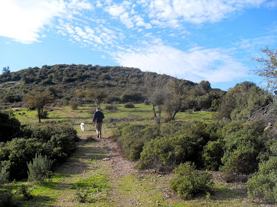
View from Temera. 


Next time I'll post a few details of the site, (after a bit of internet trawling) . 


Wednesday, 19 December 2012

Syangela - Alazeytin Castle.


At the weekend the rain clouds retreated and the sun came out again.  After a week of urban walking it was a chance to get back to the countryside and resume Jake the dog's archaeological education. 
We headed out towards Çiftlik with the aim of visiting Syangela.  As usual we got lost, argued about whose fault it was that we'd got lost, back-tracked to the Town Council building in Yalı where a very helpful Osman showed me the route on Google earth, printed out a map and smilingly sent me on my way.  


Syangela is one of eight Lelegian towns around Bodrum. Not much is known about the history of these sites, but they pre-date the Carian cities and were probably at their most populous from the 7th to 4th centuries BC.  We know from Strabo that Mausolus, the Carian ruler, forced the citizens of all the Lelegian towns except Myndos and Syangela to move to Halikarnasus (Bodrum) in the 4th century BC.  It is also on record that Syangela  had a governor called Pigres, paid a tribute of a talent as a member of the Delian League and minted silver coins with griffin heads in 500BC.   All the Lelegian sites are found on hills with panoramic views and sturdy defensive walls with frequent look-out towers surrounding their houses. This didn't however prevent the city being sacked by the Persians.  The wall that Jake is standing beside below is  a typical Lelegian wall:  built using roughly dressed smallish stones. 


This is a good site to compare the Lelegian and Carian building styles. In the centre of Syangela there is a single tower (below) obviously Carian in style with its much larger well dressed stones.


Having said all this, there is also the possibility that this isn't the site of Syangela at all. In recent years, a new discovery has cast doubt on the identification of the remains. Either way it's a pleasant walk to a Lelegian fortress.

Update - 20/2/15  - I've just been to wonderful lecture on  The Lelegians by Dr. Adnan Diler and was able to ask my question about Syangela directly.  It seems that Syangela was originally founded on Kaplan Dağ, close to but not at Alazeytin and was moved by Mausolus to the site now called Theangela.   


The route:  From Bodrum follow the signs to Yalı-Çiftlik.  After Kızılağac village look out for a left turning sign-posted to Alazeytin. Follow this road up through the trees and the first houses of Alazeytin and you come to a junction - the road divides into three. You can't miss it as there is a stone quarry and a flag pole in front of you.  Take the right hand road. It's quite rough so you may want to leave your car just after this turning. Follow this  track passing a house on the left, then a white building on the right and you will come to a track leading to a few houses on the right. You can park here if your car has made it this far.  Walk towards these houses and at the large covered well on the right, turn left and follow the garden wall. By the time you get to the end of the wall and turn right you will see a tractor track leading up the hill to the site.